| NNNN BAD DEVELOPERS NNNN | |||||||||||||
|
EXPOSING DEVELOPERS WHO FAIL TO APPRECIATE AND RESPECT COMMUNITY, ENVIRONMENT AND SPIRIT OF THE LAND |
|||||||||||||
December 3 04: Polluted (high turbid) water from Lake A, via Lake E ends up in Yarra River where Lake E (a natural billabong) meets the Yarra River. No discharge from the construction works to the Yarra River was supposed to occur. Why haven't the Environmental Monitoring Committee (EMC) picked up on this clear breach of conditions? Lake E is a billabong of State & National Biological and Zoological Significance, providing habitat for endangered species such as the Broad Shelled Tortoise. It appears that discharge from this point had been occurring for 3 or 4 days before being "discovered" by people associated with Friends of the Earth. If these people had not have made this discovery then it is quite likely that millions of litres of highly turbid water could have leaked into the Yarra River over the December/January period.
December 3 04: Polluted (high turbid) water from Lake A, via Lake E ends up in Yarra River where Lake E (a natural billabong) meets the Yarra River. Macquarie Perch are supposedly spawning at this time of year. Apparaently this major 'leak' where the billabong meets the Yarra River was 'blocked' after the pollution incident was reported. This leaves the question, how much turbid water remains in the billabong?
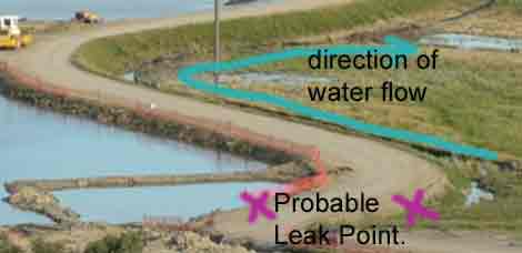
December 3 04: Probable source of discharge from Lake A. Blue line shows probable flow of water from leakage point, along the outside of Global Silt Barrier (Levy). The water then flows through apparent straw bales, across the flood plain towards a discharge point at Lake E. Due to the poor quality of the water entering the Yarra River from Lake E, the hay bales are insufficient to filter out all of the water polluted with sediment from construction works.
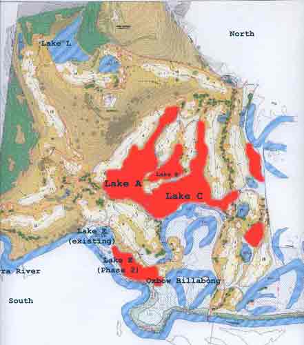
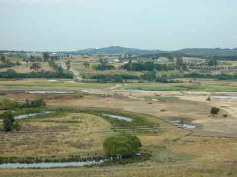
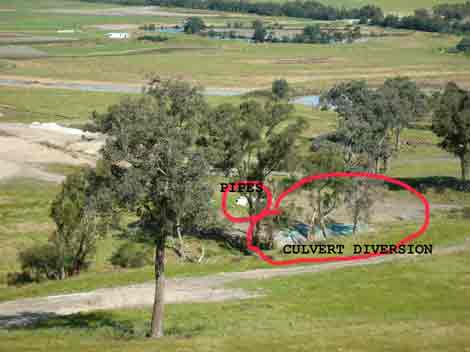
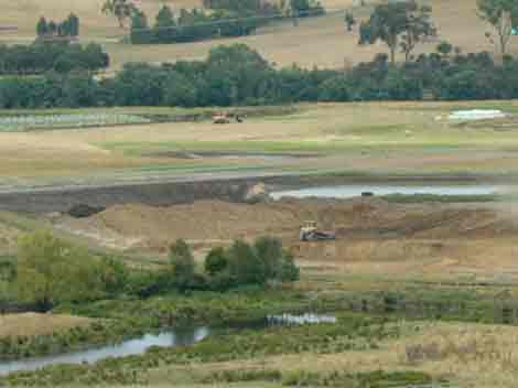
Course Map: Red indicates lakes to be gouged from the floodplain. November rains have currently inundated the Lake A, B and C areas. Works cannot continue in the areas currently underwater. The Developers want to desperately release water in order to continue construction of the main Lake system. They have proposed pumping water from Lake A into Lake L and then releasing the Lake L water via the western gully, which flows into the Yarra just downstream from Lake E. However the Development Plans states that water released into the Yarra must be of the same quality as the Yarra River. Water from Lake A went as high as 984 NTU's on 5 November 2004. In November, Lake A Nitrogen levels were over 800% above SEPP Waters of Victoria Guidelines Schedule F7 - Waters of the Yarra Catchment. Phosphorus levels were 1000% above the SEPP. It will be a very difficult exercise to bring the water quality up to good enough release quality. Meanwhile the development continues to stall.
Lake E will be extended in Phase 2 of this highly risky venture in the next 12 months. The Lake E 'extension' needs to be stopped and the course redesigned to incorporate existing topography..
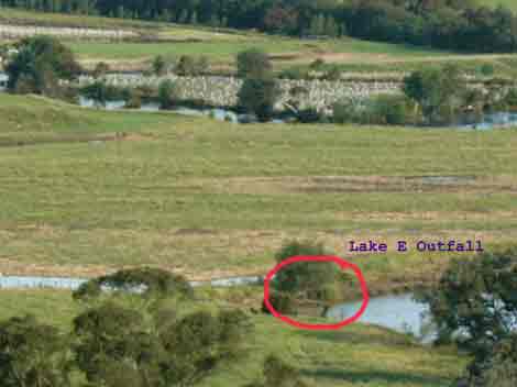
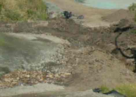
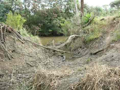
Dec 3 04: After crossing the floodplain the polluted water enters Lake E via a pipe at the approximate point circled in red.
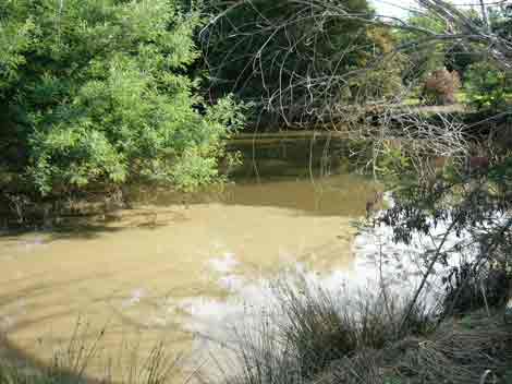
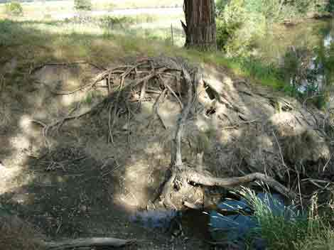
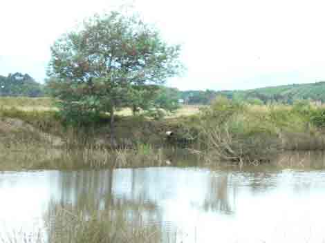
Dec 3 04: Lake E - a natural billabong, showing the point where turbid water from Lake A has discharged from. Photo taken from crown land access point near Yarra River.
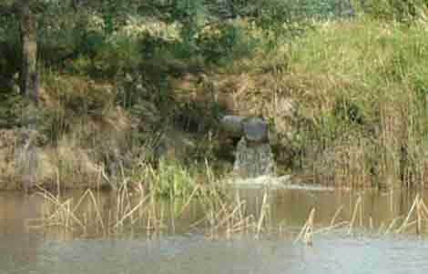
Dec 3 04: Close up of above showing discharge pipe.
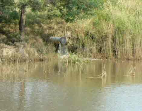
Dec 3 04: Another angle of discharge pipe into Lake E.
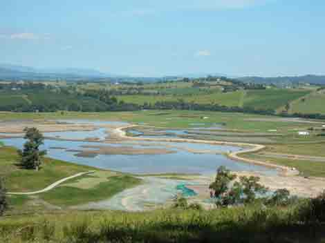
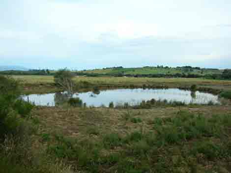
Dec 3 04: Henley flood plain, about 18 days after a 1:2 year flood was recorded. Note that most of the billabongs still contain water, meaning that groundwater levels are still saturated. Further rain will mean more water on the floodplain, meaning that construction works will be delayed further.
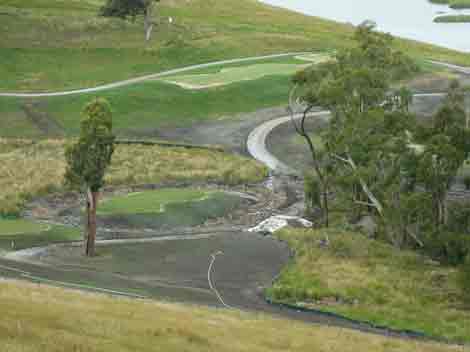
Dec 3 04: Some construction work has been conducted on the east side of the course.
Dec 3 04: Remedial work on 12th hole gully crossing.
Dec 3 04: Close up of remedial work. Note piles of soil left above gully. In the event of heavy rain most of this soil will be washed down western side gully.
Dec 3 04: Yarra Valley Golf are desperately trying to get permission from Melbourne Water and the EPA to divert water from their dam at the top of the 13th hole, along western gully, to be discharged directly into the Yarra River. At the moment this water is currently diverted into Lake A from the gully and is contained behind the Global Silt Trap (which as shown earlier is leaking). Has Melbourne Water granted permission for the water to now flow into the Yarra River? Current culverting and drainage works indicate that Yarra Valley Golf are planning this outcome. Water making its way from this gully is supposed to be of the same quality as that of the Yarra River, however even if water leaving the dam is of good quality, by the time it makes its way down the western gully, it may be very turbid.
Dec 3 04: New Culverts on western gully.
Dec 3 04: Piles of uncontained sediment and soil in very close proximity to western gully. In the event of heavy rain, much of this sediment could be washed into the gully, thereby worsening water quality flowing down the gully.
Dec 3 04: Western Gully where it meets the Yarra River. Note the highly eroded banks of this gully. One would hope that if a licence is granted by Melbourne Water to discharge into the Yarra River via this point, that gully revegetation works are completed prior to permission being granted, otherwise more erosion could eventuate, leading to highly turbid water entering the Yarra.
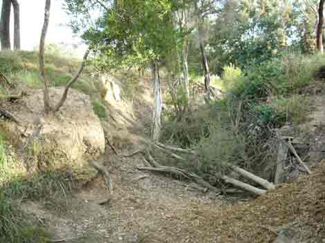
Dec 3 04: Western gully just up from the Yarra River. Note high erosion problems likely to be encountered at this point, leading to further sedimentation of discharged water.
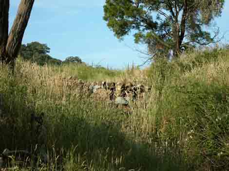
Dec 3 04: Gully with rock barrier, supposed to control sediment and erosion of western gully.
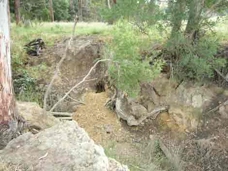
Dec 10, 04: Western gully wombat hole
Dec 10, 04: Western Gully where it meets the Yarra River. Very high erosion potential.
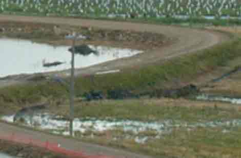
Dec 10, 04: Leaked water from Lake A still spilling over floodplain. Golf course has installed a pump to pump water leaking from Lake A, back into Lake A, thereby stopping it entering Lake E.
Dec 10, 04: Leaking bund area is where excavator is located in photo. Water has been pumped out of most this area, but water could still be seeping under bund. Note extent of water still on floodplain and note high water level in lake A (left of screen).
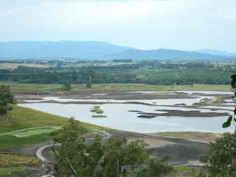
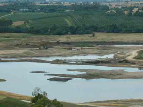
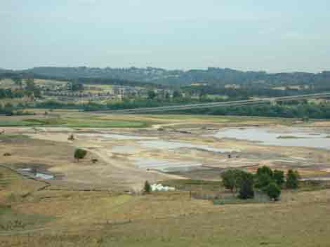
Dec 10, 04: Henley Floodplain, showing Lake A on the left and Lake E on the right. One week earlier, very turbid water had discharging from Lake A, flowing over the floodplain into Lake E and then into the Yarra River.
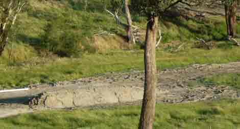
Dec 10, 04: 12th hole gully crossing.
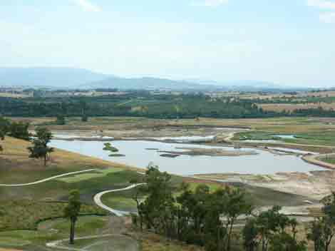
Dec 10, 04: Henley flood plain, Lake A still full of water, although recent works have been occurring on the eastern side of the course.
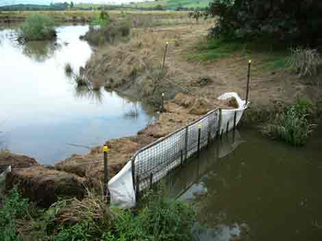
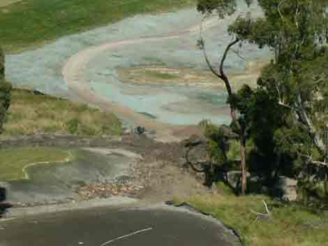
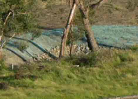
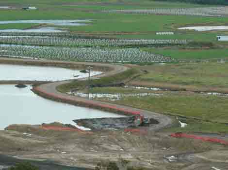
Dec 10, 04: Yarra Valley Golf have installed this 'silt trap' to stop heavily turbid water from flowing into the Yarra River. Water quality from Lake E likely to be very poor.
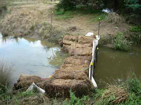
Dec 10, 04: Lake E/Yarra River silt trap. In the event of floods Yarra River water will simply wash over this construction.
Dec 10, 04: Water has stopped flowing from the outlet pipe into Lake E. However what's to stop this pipe from being reused at night when noone is watching?
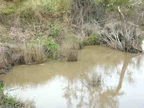
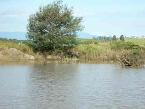
Dec 10, 04: Highly turbid water in Lake E, a billabong of state and national zoological and biological significance. This billabong has been polluted by Yarra Valley Golf Pty Ltd.
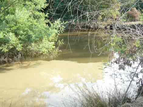
Dec 10, 04: Lake E Billabong.
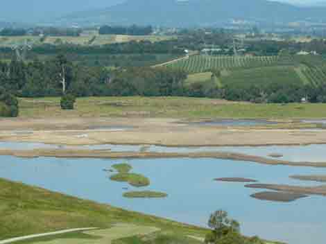
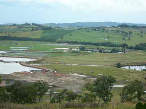
Dec 10, 04: Henley Flood Plain looking north east
Dec 10, 04: Lake E Billabong. Threatened with heavily turbid construction water.
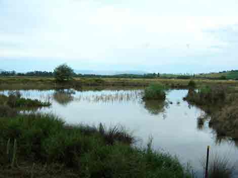
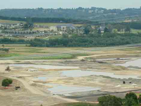
Jan 27, 2005: View looking east. Water still backed up in construction site. Most development occurring on eastern side of development. Little of this water has evaporated since the November rains 2 months earlier. Groundwater levels remain high.
Jan 27, 2005: View looking east.
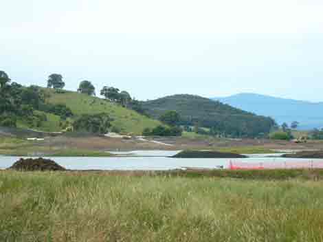
Jan 27 2005: View looking south along eastern side of development.
Jan 27 2005: View looking south along eastern side of development.If a flood event occurs this eastern side will be the area most likely to be flooded first. Note sediment retention.
Jan 27 2005: Eastern side of the development.