| NNNN BAD DEVELOPERS NNNN | |||||||||||||
|
EXPOSING DEVELOPERS WHO FAIL TO APPRECIATE AND RESPECT COMMUNITY, ENVIRONMENT AND SPIRIT OF THE LAND |
|||||||||||||
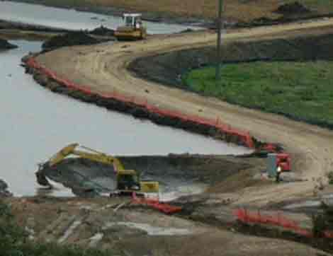
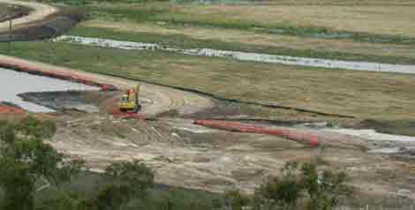
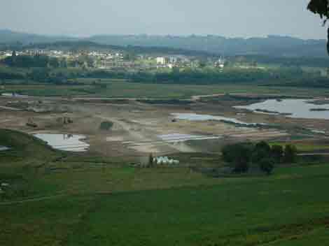
February 3 2005: Main "leakage point" of Global Silt Barrier (Lake A), which sprung a big leak in December 2004. The company was not fined for this apparent oversite. The leak had been occurring for three days before being found by members of the public. If the public hadn't uncovered this fiasco, turbid construction water could have been released by Yarra Valley Golf Pty Ltd for months and noone would have been the wiser. This photo reveals the company trying to 'protect' the leakage point by diverting water away from the bund wall. This photo reveals that the leak hasn't entirely been fixed. Apparently the Lake A bunds were designed to hold water capacity for a 1:100 year flood. What happened? Why is the bund leaking? Will it leak in other places? How stable is the bund? Why was it approved by authorities without being thoroughly assessed? Why weren't the public allowed to see engineering plans for the bunds?
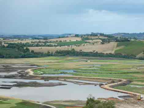
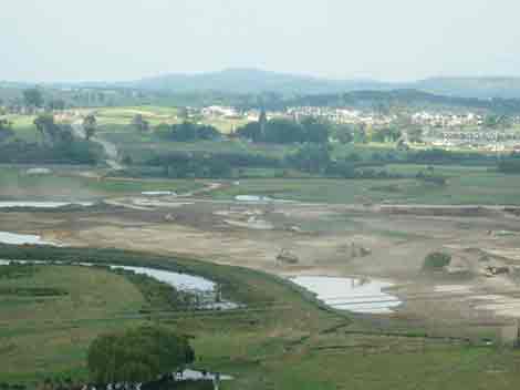
February 3 2005: If the bunds are breached most of the highly turbid water seen in this photo could flood into highly significant native fish habitat of the Yarra River upstream of the Bend of Islands.
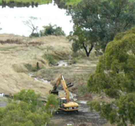
On December 3, 2004 the EPA was alerted to the fact that highly turbid water was being discharged from the Henley Golf Course construction. The EPA responded quickly and conducted a site inspection on December 4. By February 3 2005 however, the EPA had still failed to issue the golf course with a Pollution Abatement Notice. The company finally constructed this barrier a few days after the EPA inspection to stop highly turbid water from Lake E flowing into the Yarra River. Why has the EPA waited 2 months to issue the abatement notice? With such constraints on developers doing the wrong thing, developers must be laughing all the way to the bank.
Meanwhile . . .
February 3 2005: Yarra Valley Golf Pty Ltd are now discharging water along the Western Gully straight into the Yarra River. Such discharge has not yet been agreed to by Melbourne Water, the EPA or Environment Australia? If not then why is this water being discharged and what is its quality? What will the above authorites do to stop such action occurring again?
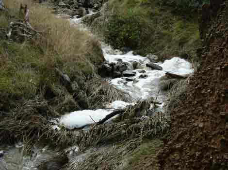
February 3 2005: Western Gully - The Golf Course was nowhere near flooding so why release this water?
According to Melbourne Water; "Henley Golf and Country Club Environmental Management Plan Henley Course Construction January 2003, under section 5 Construction Program
Discharge to the Yarra River before the course is fully vegetated and operational is to occur when the water to be discharged is equal to or better than the quality in the Yarra River (based on N, P and SS).
The Integrated Environmental Management Plan Construction states on pages 4-5
Discharge to the Yarra River before the course is fully vegetated and operational is to occur when the water to be discharged is equal to or better than the background quality in the Yarra River (based on Turbidity, but including N, P and SS).
Background is defined as measurements of turbidity representative of local ambient conditions. To be representative of the Yarra River without influence of the construction activities, the background sampling site will be at the upstream (eastern) boundary of the project site (approximately 700 m upstream of the active works area).
... if Heritage Golf and Country Club deem it necessary to pump water to the Yarra River they need to submit a proposal that is in accordance with the EMP. Any proposal, should include details of water quality testing and sampling procedures, water treatment measures, discharge volumes and discharge rates. As part of this application process, Melbourne Water would work closely with the Environment Protection Authority Victoria to assist in determining a response that is consistent with the requirements of the EMP. Any determination and or approval will be reported to the EMC."
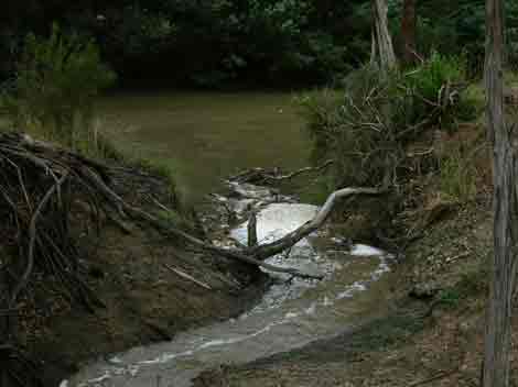
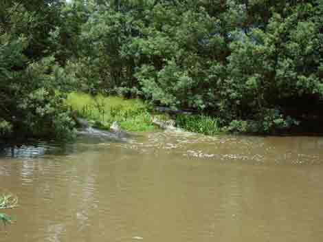
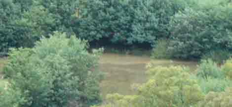
February 3, 2005: Where the western gully meets the Yarra River.
February 3, 2005: Where the western gully meets the Yarra River.
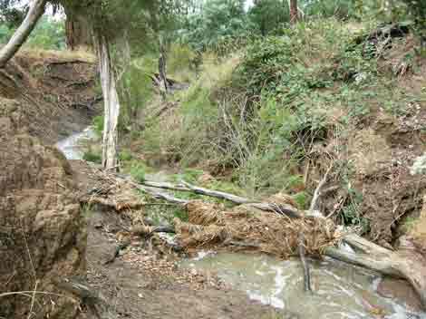
February 3 2005: Haybales left along the side of the western gully. Yarra Valley Golf knew that a significant rain event was to occur during the week, but little care was shown by placing hay bales in the gully to minimise the risk of turbid water entering the Yarra River.
February 3 2005: Western Gully and filled in Wombat Hole.
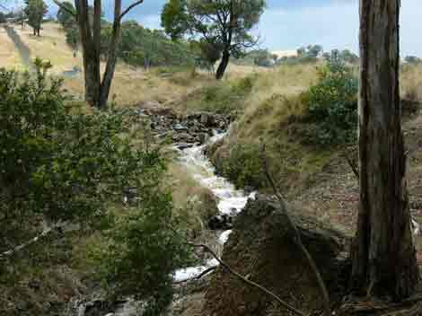
February 3 2005: A view of the western gully looking south. Note the water flowing down the gully. This water is supposed to be contained behind the Global Silt Barrier. Why are Yarra Valley Golf allowed to be discharging into the Yarra?
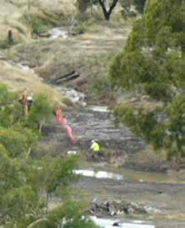
February 3 2005: Checking culverts for blockages on western gully?

February 3 2005: Western Gully. Water had been discharged at greater velocities earlier in the morning of Feb 3.
February 3 2005: Western Gully
February 3 2005: Western Gully. Is the froth natural?
February 3 2005: A view of the western gully looking south. Note the water flowing down the gully. This water is supposed to be contained behind the Global Silt Barrier. Why are Yarra Valley Golf allowed to be discharging into the Yarra?
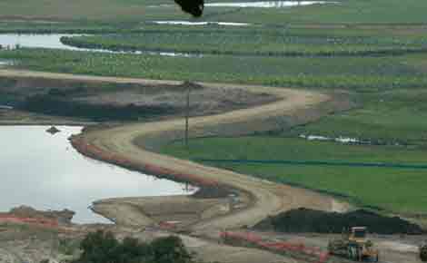
February 3 2005: A view Lake X which sits along the western gully and is supposed to take diverted water from the gully and direct it into Lake A which is located behind the Global Silt barrier. Does this photo reveal that the water level in Lake X was much higher during the morning of February 3? Is this the water that has been released down the western gully?
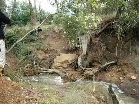
February 3 2005: Poorly formed creek crossing near 12th hole. This gully crosses the western gully and is a notable erosion hotspot. Water still banks up at this site, due to inappropriate drainage measures at this spot and along the 13th hole. How much sediment, sand and pollutants runs off the 13th hole, this creek crossing and the western gully before being now discharged into the Yarra? Who was the genius who designed this?
Lake L which sits at the top of the 13th gully. Excess water from Lake A is supposed to be pumped into this Lake where pollutants are supposed to settle out. The water is then supposed to be released down the western gully only when water quality in Lake L is better than that of the Yarra River. But who is checking?
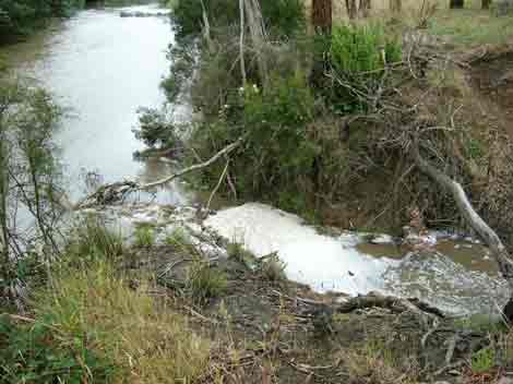
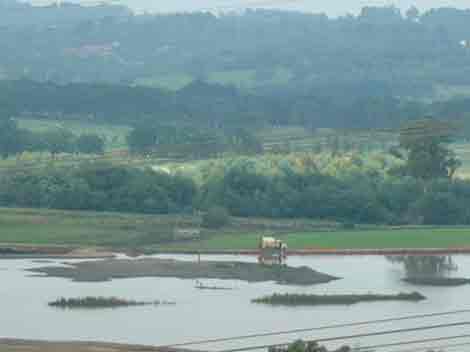
February 3 2005: Water being released into the Yarra River from the Heritage Golf and Country Club on the south side of the Yarra.
February 3 2005: Water being released into the Yarra River from the Heritage Golf and Country Club on the south side of the Yarra. Note the sediment plume forming immediately downstream of the discharge point.
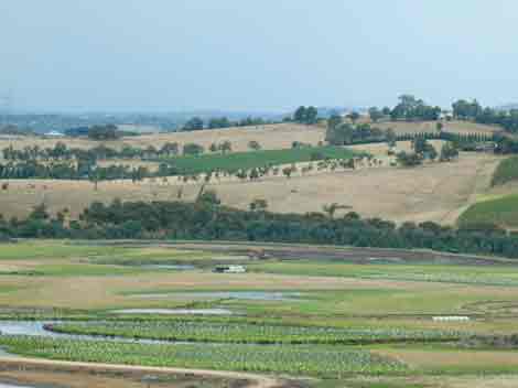
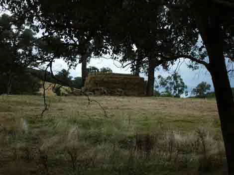
February 3 2005: Location of the Turf Grass Nursery - the bulldozed land in the distance on the floodplain. Herbcides and fertilisers will be allowed at this location. The Nursery was recently granted approval by Environment Australia.
February 3 2005: What's to stop water being pumped from Lake A directly to Lake X and then released down the western gully directly into the Yarra River?
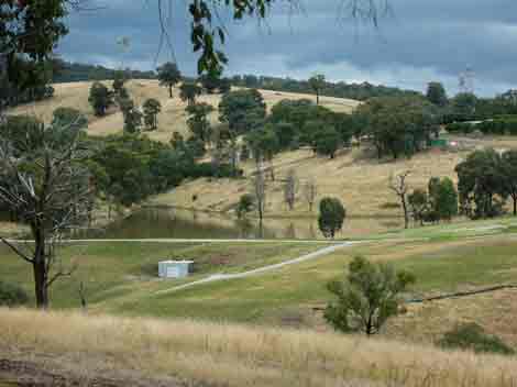
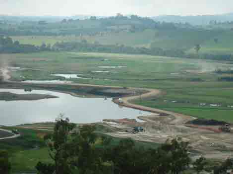
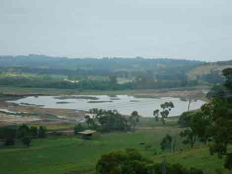
February 2005: The now infamous Lake A, still gorged with water from the November flood. Yarra Valley Golf are desperate to release this water which is also likely to be gorged by rising groundwater.
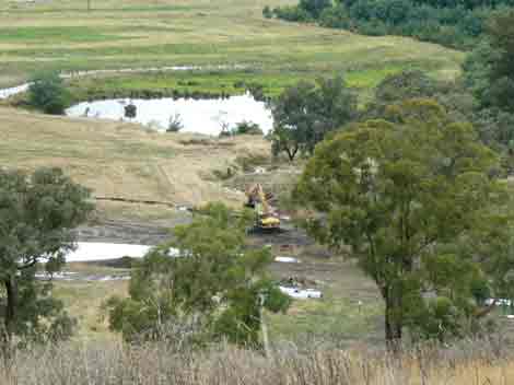
Feb 20: Henley flood plain. Eastern portion of Lake A appears to have been partially filled. Most works occurring on eastern side of development. Still no word from EPA regarding breaches of permit.
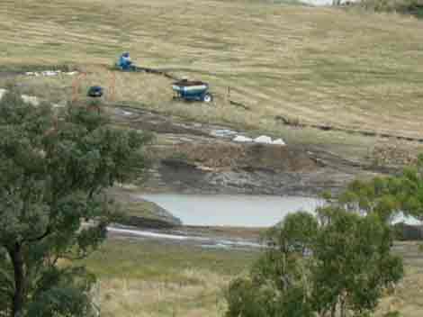
February 20 2005: Recent works occuring outside of Global Silt barrier, near Lake E. Also note back up of water across floodplain. Is the bund/levee still leaking?
Feb 20 2005: Closer view of main levee/Global silt barrier. Water level still quite high.
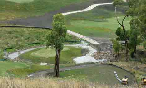
Feb 20: Works have commenced in very close proximity to Yarra River on south western edge of course. Have Phase Two works commenced?
February 20 2005: Global Silt Barrier showing recent works to get water away from high risk leakage points.
Feb 20 2005: Recent works on eastern side of the development.
Feb 20 2005: Recent works on eastern side of the development. A flash flood would hit this area first.
Feb 20 2005: Recent works on eastern side of the development. A flash flood would hit this area first.
February 20 2005: Lake A still holding alot of water primarily from November 2004 rainfall and rising groundwater.
February 20 2005: Water truck filling up. This water is then sprayed over roads to keep dust down.
What a fiasco!